
REVIEW · HIKING & TREKKING
Discovery hike along the Trondheimsfjord
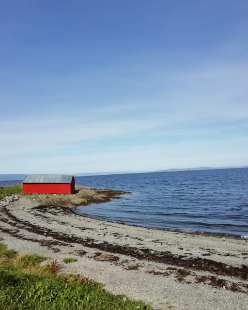
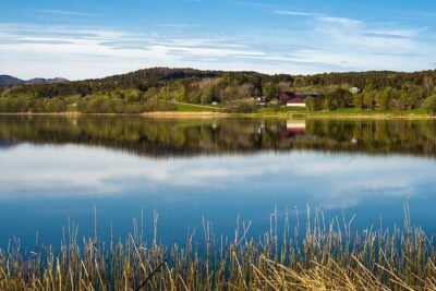
Fjord views plus WWII ruins equals a smart outing. This one-way Ladestien hike along the Trondheim Fjord mixes easy coastal walking with photo stops and history, including Second World War remains like the Østmarka German bunker, guided by Gaäl. I love two things most: the photo stops with explanations that turn a walk into a lesson, and the relaxed pace that helps you feel the Norwegian coastal lifestyle instead of rushing past it. The main drawback to plan for is that the route is not a loop, so you finish at Rotvoll and need bus 20 to get back.
Timing matters too. The hike runs from March to October, and Trondheim weather can shift fast, so bring layers and comfortable shoes that handle wet ground and wind.
In This Review
- Key points to know before you go
- A fjord hike that feels like local life, not just a view
- Price and value: what $72 covers (and what it does not)
- Getting to the trail start without stress
- The route in real terms: one-way, 6 km, medium difficulty
- Stop 1: Korsvika, where the hike starts with a purpose
- Østmarka German bunker: turning coastal ruins into context
- Ladekaia photo stop: where the fjord meets the city’s working coast
- Sponhuset: a quieter stop with strong atmosphere
- Devlebukta viewpoint: the hike’s payoff as you near the finish
- What makes the guide matter so much
- Weather and clothing: the small choices that keep the hike pleasant
- How long to plan, and how to fit it into your Trondheim day
- Who should book this (and who should skip it)
- Should you book the Discovery hike along the Trondheimsfjord?
- FAQ
- How long is the hike?
- How far is the hike?
- When does the tour run?
- How hard is it?
- Is it a loop or one-way hike?
- Where do I meet the guide?
- What buses do I use?
- Are food and drinks included?
- What should I bring?
Key points to know before you go
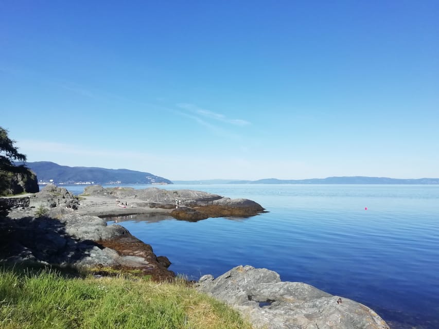
- 6 km, 2.5 hours, medium: a good “half-day” effort that still leaves time for the rest of Trondheim.
- One-way route, simple transit: start at Korsvika, finish at Rotvoll, then use bus 20 back to the city center.
- WWII remains with context: expect stops such as the Østmarka German bunker, plus other Second World War-era structures.
- Photo stops that teach: you pause often, not just to take pictures, but to understand what you’re seeing.
- Real local vibe: the Ladestien area feels like part of daily life, not a staged viewpoint circuit.
- Language support in French or English: the guide delivers the stories in your chosen language.
Undecided? Weigh it beside the Trondheim bookings that graded hardest on our Norway desk.
- Trondheim Like a Local: Customized Private Tour★ 4.7 · 92 reviews
- Trondheim : Explore the city of kings with a local guide★ 4.8 · 70 reviews
- Trondheim: 2-hour City Walking Tour★ 4.2 · 51 reviews
- Trondheim: Discover the city of kings with a local guide★ 5.0 · 41 reviews
A fjord hike that feels like local life, not just a view
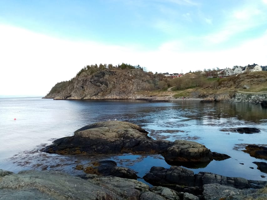
This is the kind of outing that quietly works. Yes, you get great coastal views along the Trondheim Fjord. But what makes it worth your time is how the guide connects the dots between the water, the Lade peninsula, and the way Trondheim has lived with this coastline for generations.
You also get a steady walking rhythm. You are not sprinting from one “big sight” to the next. Instead, you move through beaches, viewpoints, and old structures at an easy-to-manage pace. That matters, because it keeps the hike enjoyable even when the weather turns moody.
And then there is the history element. You’re not just looking at random ruins. The tour points you toward why those places exist and what they meant for the city and the coast during the Second World War.
Price and value: what $72 covers (and what it does not)
At $72 per person for about 2.5 hours, you are paying for something specific: a local guide plus a structured hiking experience. For this kind of walk, the value is not the distance. It is the way the guide turns stops into understanding.
Two practical notes help you judge the value quickly:
- The hike is only 2.5 hours, so you are not paying for a full day.
- Food and drinks are not included, so if you tend to get hungry, plan ahead.
If you already enjoy outdoor walks, this price makes sense because you are buying guidance, pacing, and interpretation. If you only want a quick self-guided stroll with no history context, you might feel the cost more than the experience.
Getting to the trail start without stress
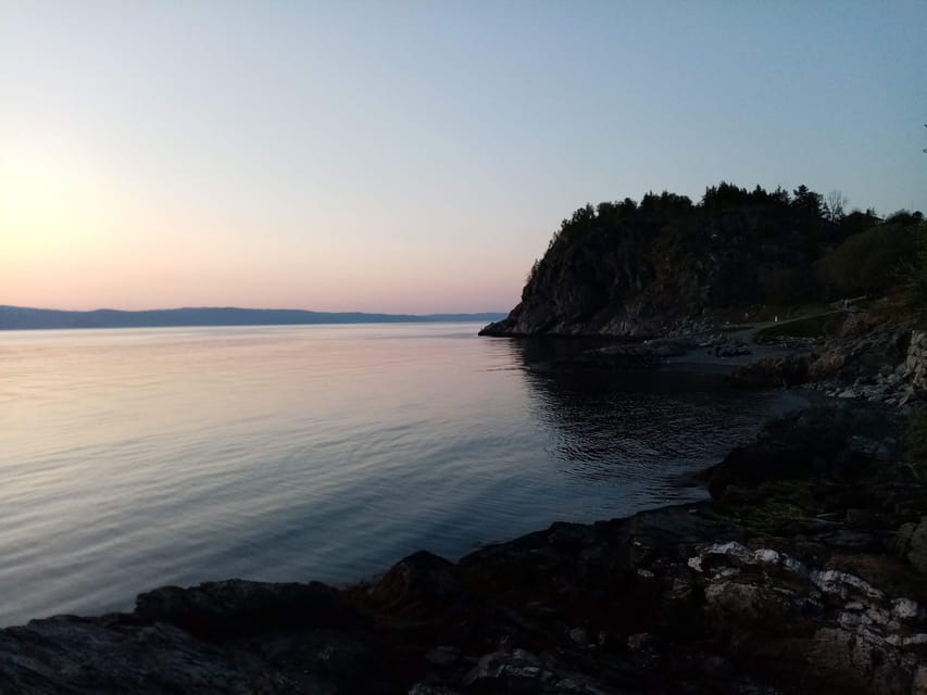
The meet-up point is the Korsvika car park, close to the bus stop Ingemann Torps vei. From Trondheim’s city center, you take bus number 2 toward Strindheim. Buses run roughly every 10 minutes, which makes it easy to time your arrival.
Once the hike ends, you finish at Rotvoll. The Rotvoll bus stop is about a 10-minute walk from the end point. Then bus number 20 heads toward Romolslia, and from there you can work your way back to the city center.
A small but helpful local tip: use the ATB app for the most up-to-date schedules and ticketing. In Norway, public transport is usually reliable, but it is still smart to check the latest timing.

The route in real terms: one-way, 6 km, medium difficulty
You should think of this as a one-way coastal hike of about 6 km, designed for a medium level of effort. “Medium” here means you should be comfortable walking continuously for the full 2.5 hours, not that you need mountaineering gear.
It is not a loop. That’s the big planning point. Your start and end are different, so you should schedule your transit from the beginning, not at the last minute.
The tour runs from March to October, and that seasonal window is worth respecting. If you go outside it, you won’t have this specific guided option. Even during the season, bring clothing that handles wind and quick shifts in temperature.
Stop 1: Korsvika, where the hike starts with a purpose
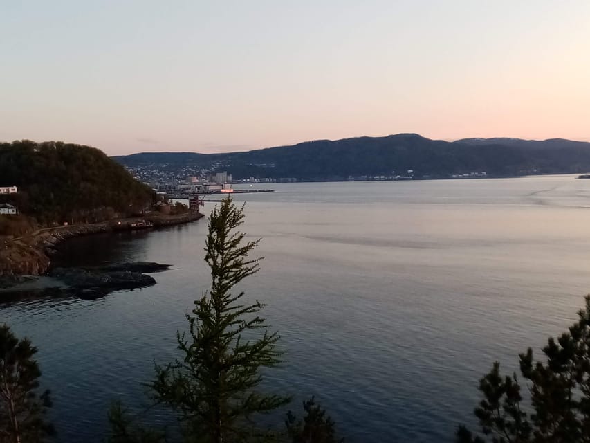
Korsvika is not just a parking lot. It’s the start of the route along the Ladestien coast, and the guide uses this first point to set expectations and get you ready for the walk.
Expect a photo stop right away. That sounds simple, but it often helps your brain adjust to the scenery. You start learning what to look for before you’re halfway down the path. If you like taking photos, this early pause is a good “baseline,” because later stops will make more sense after you’ve already been oriented.
Practical advice: if you’re the type who wants the best angles, be ready early. Early in the hike, you tend to have more energy and better timing for lighting.
Østmarka German bunker: turning coastal ruins into context
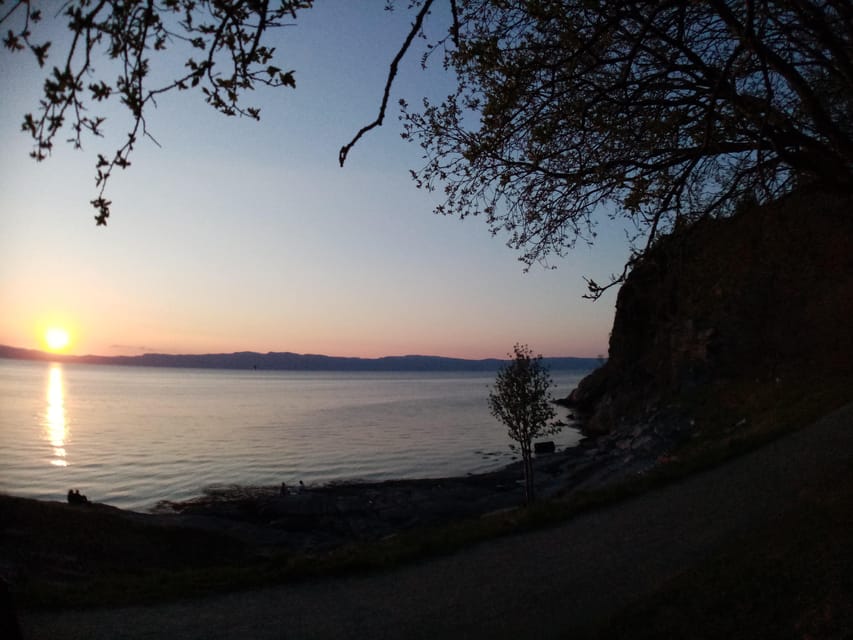
One of the best parts of the experience is how it handles the Second World War remains. The Østmarka German bunker stop is one of the clear history anchors of the hike.
You’ll be looking at structures left behind from a real wartime presence. What you gain is context, not just sightlines. The guide helps you understand how these remnants fit into Trondheim’s story and why they are still visible in the present-day landscape.
This stop is also a good reminder that the fjord area is layered. It’s not only nature and views. It’s also human decisions, conflict, and survival, all written into the places you walk past today.
Comfort note: bunkers and coastal edges can mean uneven ground or damp surfaces near old structures. Wear shoes with grip.
Ladekaia photo stop: where the fjord meets the city’s working coast
As you continue along the coast, you reach Ladekaia for another photo stop. This is the kind of place that helps you see Trondheim beyond its city center.
The guide’s explanations at this point matter because they frame what you’re looking at. You’re not just photographing a scenic stretch. You’re learning how the Lade peninsula functions as part of Trondheim’s relationship with water, movement, and settlement.
If you like travel that feels grounded in daily geography, Ladekaia is a satisfying stop. It connects the natural setting to the way people have used this coast.
Sponhuset: a quieter stop with strong atmosphere
Next comes Sponhuset, another photo stop. This is one of the moments where you likely feel the coast’s mood shift. The route keeps you close to the water, but the structures and ruins add a different kind of weight to what you see.
What makes Sponhuset work on this tour is the pacing. You do not rush past. You stop, listen, look around, and then move on when the story has landed.
For photography, this is often a “slow down” moment. If you’re trying to capture both the structure and the fjord behind it, you’ll benefit from taking your time here rather than at the end.
Devlebukta viewpoint: the hike’s payoff as you near the finish
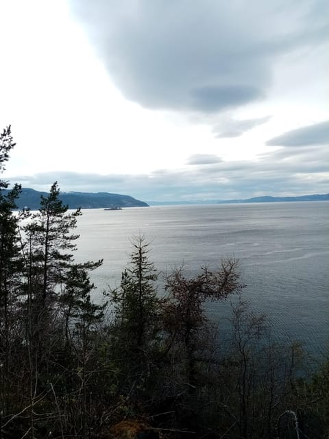
As you approach the end, Devlebukta becomes one of the last strong visual points. The fjord views here are part of the reason the hike is worth choosing over a pure city walking tour.
This is also where the story pieces can click together. Earlier you learned about wartime remnants and coastal history. Now you’re seeing how those elements sit inside a living coastline, with ongoing flora and fauna along the peninsula.
You might not leave with a list of plant species or bird names, because the tour focuses on learning about the natural setting in general. Still, you get the sense that this coast is active and not frozen in time.
What makes the guide matter so much
The experience is guided in French and English, and the guiding style is a big part of the value. Gaäl, mentioned by guests, is the kind of guide who keeps stories organized while still sounding human and upbeat.
You can feel it in how stops are handled. Photo pauses are not random. Each one is tied to what you should notice next, whether it is history, the coastline, or the living environment.
One small perk from past departures is that the hike has run even when there was only one participant. That tends to make the experience more personal. You get more time for questions and less of the group “herding” feeling.
Weather and clothing: the small choices that keep the hike pleasant
Outdoor hikes in Trondheim can be a coin toss. Wind off the fjord can make it feel colder than you expect. Wet paths can be slippery if your shoes are too smooth.
Bring:
- Comfortable shoes with grip
- Comfortable clothes you can layer
Plan for the possibility of rain. Even if the weather is mostly fine, coastal wind can change your comfort fast. If you’re someone who gets cold easily, start dressed for cooler conditions.
How long to plan, and how to fit it into your Trondheim day
Two and a half hours is a sweet spot. Long enough to feel like a proper outing, short enough to still enjoy the rest of your day.
Because it is one-way, your schedule needs one extra detail: do not plan your next activity to start right at the finish time. You need the walk to the Rotvoll bus stop, plus time for waiting.
If you want a smoother day, do this hike earlier rather than later. When you finish, you’ll likely have energy for a meal or a final stroll in town, instead of feeling wiped out.
Who should book this (and who should skip it)
This hike is a great match if you want:
- A guided outdoor walk with history built in
- A route that feels like an authentic coastal neighborhood
- Photo stops with explanations, not just a checklist of sights
It might be less ideal if:
- You need wheelchair accessibility (this tour is not suitable for wheelchair users)
- You want a loop you can complete in the same area
- You do not enjoy outdoor walking in changing weather
Also, if you hate the idea of being on the move the whole time, remember this is 6 km in about 2.5 hours. You will pause often, but you are still walking.
Should you book the Discovery hike along the Trondheimsfjord?
I’d book it if you like travel that has a point of view. You come away with more than photos. You get a story stitched into real places, from the Østmarka German bunker to the coastal stops that lead you toward Devlebukta and the end at Rotvoll.
It is also a good pick for value. For $72 you are paying for a guide who turns the walk into learning, and the timing is efficient. Just go in knowing it is one-way and food is on you.
If you want the easiest day in Trondheim, skip it. If you want a calm, meaningful fjord hike with just enough history to make it memorable, this is a strong choice.
FAQ
How long is the hike?
The hike lasts about 2.5 hours.
How far is the hike?
It is about 6 km.
When does the tour run?
The tour is available from March to October.
How hard is it?
The difficulty is listed as medium.
Is it a loop or one-way hike?
It is not a loop. It is a one-way hike with different start and end points.
Where do I meet the guide?
You meet at the Korsvika car park. The guide will have a sign for Gaël & Maëlle Travel.
What buses do I use?
From the city center, take bus number 2 toward Strindheim until Ingemann Torps vei. After the tour, take bus number 20 from Rotvoll toward Romolslia.
Are food and drinks included?
No. Food and drinks are not included.
What should I bring?
Bring comfortable shoes and comfortable clothes, and dress for unpredictable Norwegian weather.
More Tour Reviews in Trondheim



Newest Trondheim write-ups off our Norway desk
- Panorama Bus Tour with Audio Guide
★ 4.0 · 3 reviews - Best of Trondheim: Private Walking Tour with a Local
★ 4.7 · 3 reviews - Discovery hike along the Trondheimsfjord
★ 5.0 · 4 reviews - See the city power-walk
★ 4.5 · 6 reviews - Discover the unmissables places of Trondheim
★ 4.5 · 6 reviews - 2 Hour City Walk through Trondheim
★ 4.5 · 8 reviews
More in Hiking & Trekking.
 ★ 4.8From Tromsø: Snowshoeing Hike with Picnic Lunch and PhotosFrom $152637 reviews
 ★ 4.9From Tromsø: Guided Husky Snowshoe Hike and Husky Camp VisitFrom $175555 reviews
 ★ 4.9From Tromsø: Snowshoe Hike in the ArcticFrom $157467 reviews
 ★ 5.0Guided hike to Pulpit Rock PreikestolenFrom $149390 reviews
 ★ 4.9From Stavanger: Pulpit Rock Guided Hike with PickupFrom $145294 reviews
 ★ 4.8Stavanger: Preikestolen (Pulpit Rock) Hike with Local GuideFrom $167279 reviews
 ★ 4.9Stavanger: Preikestolen Classic Hike and Side TrailFrom $140180 reviews
 ★ 4.5Guided hike to Kjerag and KjeragboltenFrom $182166 reviews
Lists this one sits in